
Karungi on the Torne River: Riverside location and history
Accommodation in Karungi
Karungi combines a location right on the Torne River with a cross-border perspective: the Finnish neighboring village of Karunki lies on the opposite bank. For travelers, the river provides a precise point of reference for the town’s location. Other highlights include the history of Karl Gustav Church, events from the railway era, and a cycling route to Haparanda. If you are looking for hotels in Karungi, these topics can help shape your choice of location: would you like to focus mainly on the riverside setting, historic sites, or cycling when planning your trip? Karunki’s location across the river is a clear geographic reference point, while the church and railway history cover different periods.
Riverside setting and landscape
The terrain in Karungi is very flat, and the town lies in an area shaped by agriculture. These two features offer different clues about the local landscape: the terrain is level, while agricultural use defines the area. If the shape of the landscape is also a factor in choosing where to stay, the flat topography provides a concrete point of reference. This gives you two criteria for understanding the town, rather than describing the landscape only in general terms.
Church and local history
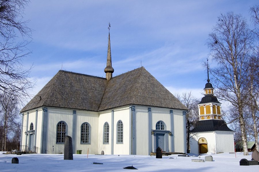
Karl Gustav Church stands on Kyrkholmen, a part of town on a peninsula in the Torne River. It was built in 1795–1796 and is the oldest church in the Haparanda parish. The building therefore combines a precise historical date with a clearly identified location in the river landscape. The church dates from the late 18th century; the station building was inaugurated on July 1, 1913, and the “Karungi station utrikes” was built at the end of 1914.
Railway history and current rail status
When the First World War broke out, the endpoint of the Swedish railway network was in Karungi. The station building was inaugurated on July 1, 1913. At the end of 1914, the “Karungi station utrikes” was built in Karungi to handle large volumes of mail and freight. For travel planning today, it is important to note that the Morjärv–Karungi–Haparanda railway line has not been in service since 2012. As of August 24, 2026, only vegetation clearance and feasibility studies had been approved for 2026.
Cycling route and nature
For cycling enthusiasts, the Karungi–Haparanda route offers another concrete option and is 26 km long. Karungi itself lies on the banks of the Torne River; after leaving the town, the route passes through an open river landscape. The route’s length gives you a concrete measure for planning, while the landscape description provides context for the stretch beyond Karungi.
Check road conditions before setting out
As of February 10, 2026, the surface of Väg 737 in Karungi had previously been removed due to extensive damage. Conditions and works may change, so check the latest status before setting out.
Discover more destinations: Kukkola, Haparanda.
Return to the main travel overview: Haparanda.

