
Paprotki on Lake Paproteckie
Accommodation in Paprotki
Paprotki on Lake Paproteckie
Paprotki is located on Lake Paproteckie. If you want to take both the lake and the town’s history into account when choosing where to stay, you will find two specific points of interest here. The lake covers 28 hectares and is up to 7.2 metres deep. Its area and maximum depth describe different characteristics of the same body of water: the area indicates its extent, while the depth gives its maximum value. This gives a concrete sense of the landscape; the memorial sites and other historical evidence add a historical focus.
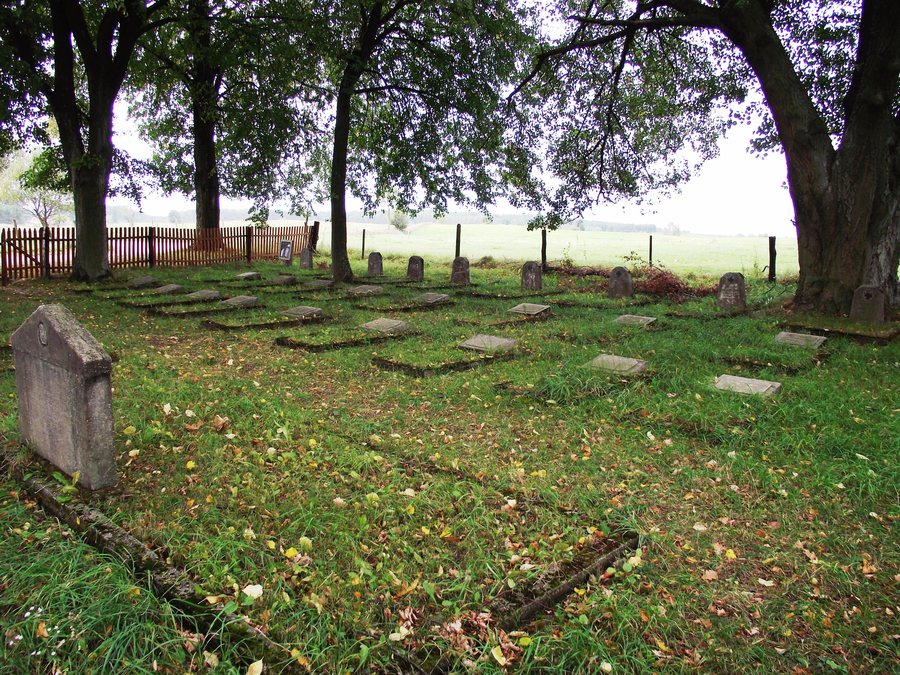 File:Cmentarz wojenny z I wojny światowej w Paprotkach.jpg
Photo: Ania P1 via Wikimedia Commons, CC BY-SA 3.0 pl
Memorial sites and their different connections
In the centre of Paprotki is a small First World War cemetery. German soldiers who fell in 1914 and 1915 during fighting in the Great Masurian Lakes region are buried there. The central cemetery contains individual and mass graves with preserved inscriptions.
Another First World War cemetery lies on a hill near Paprotki. It has a rectangular, terraced layout: the rectangular plan describes its outline, while the terraced form describes how the site is arranged. It contains two mass graves with 183 unidentified Russian soldiers, as well as 25 individual German graves with inscriptions. The cemetery is about 300 metres from the Paprotki–Górkło gravel road. Unlike the cemetery in the town centre, which is associated with the German casualties of the regional fighting, the groups of graves, nationalities and numbers here are specified.
There are three war cemeteries dating from 1914 and 1915 in the vicinity of Paprotki; the largest was established 2.5 kilometres south of the village. In addition, two old Evangelical cemeteries are located below Paprotki, at a place known as “Kamienny Park”.
Archaeological and architectural traces
Paprotki is home to a settlement and a cremation cemetery of the Bogaczew culture dating from the beginning of the Common Era. The school in Paprotki was founded in 1734; its building is considered an example of Masurian architecture. Remains of a watermill have been preserved in Paprotki. Together, these sites and structures offer different historical perspectives, from archaeological traces to the history of the school and architectural remains.
This means the timeline extends from the beginning of the Common Era, through the school’s founding in 1734, to the fighting of 1914 and 1915. These dates relate to different topics—archaeology, the history of the school, and remembrance of the First World War—and help distinguish their historical contexts.
Cycling route through Paprotki
There is also a specific point of interest for active travellers: a 140-kilometre cycle route passes through Paprotki. The route includes, among other places, Giżycko, Miłki, Paprotki, Górkło and Ryn. The length and the named places give an overview of the wider route, which includes Paprotki. If you plan to follow the route on your trip, check the current signage and trail conditions beforehand.
Discover more destinations: Wyszowate, Milki.
Go to the main travel overview: Lipińskie.

