
Coastal towns in the Kaliningrad region (Königsberg)
The coastal towns of Kaliningrad Oblast are located in a region where the security situation is a decisive factor in travel decisions: the German Federal Foreign Office currently advises against travel to the Russian Federation. The Curonian Spit remains an important historical landmark in the coastal landscape.
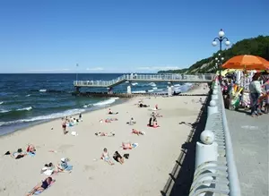 Strand von Swetlogorsk Rauschen
Photo: © oben: Nikater_Wiki_CC3.0; Mitte: Wikswat_Wiki_CC3.0, unten: Bars23_Wiki_CC3.0
Coastal region facts
- The Curonian Spit is part of the Russian-Lithuanian UNESCO World Heritage Site “Curonian Spit,” added to the UNESCO World Heritage List as a cultural landscape in 2000.
- The Russian national park covers the southern part of the spit.
- The loss of forest allowed shifting dunes to cover roads, remnants of woodland and settlements.
- The region’s historic coastal landscape is therefore also a story of human intervention and its consequences.
A landscape of sand, wind and forest
On the Curonian Spit, shifting sand shaped life along the coast over many years. By the beginning of the 19th century, deforestation had brought the landscape to the brink of ecological disaster. Dunes moved inland, burying paths, remaining patches of woodland and buildings in small fishing settlements. The coast was therefore not just a natural environment, but also a place of travel and habitation whose use depended on the stability of the ground.
The national park describes the countermeasures as a long-term effort to shape the landscape. In 1803, work began on a continuous protective barrier near the coast: brushwood fences linked sections of dunes. From 1810, slopes were also reinforced with brushwood hurdles and planted with vegetation. Further afforestation followed in the 19th century, and work on the protective dune continued until the end of the century. These measures explain why forests and dunes together define the character of the spit today.
Rossitten and the memory of the spit
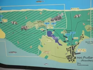
The history of settlement is also written into the landscape. Near Rossitten, now Rybachy, a nine-kilometre-long pine plantation was established in 1843. Later, near the settlement, dune inspector Franz Epha stabilised a threatened dune slope by planting vegetation. The coastal towns are therefore more than names on a map: they point to different chapters in the history of settlement, coastal protection and change. Rybachy was formerly called Rossitten.
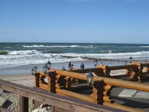
For a comparison of the towns’ profiles, see also Zelenogradsk and Svetlogorsk; both names belong to the region’s historic coastal area. Both towns are part of the coastal landscape of Kaliningrad Oblast.
Travel decisions and safety
Historical context is no substitute for current travel advice. The German Federal Foreign Office has issued a travel warning for the Russian Federation, citing, among other things, the risk of arbitrary detention for German citizens and dual German-Russian nationals. This nationwide warning also applies to the Kaliningrad coastal region. It is more important when choosing a destination than older descriptions of seaside resorts or tourist attractions. The full travel and safety advice from the German Federal Foreign Office provides the authoritative current wording.
Frequently asked questions about the coastal towns
Why do dunes feature so prominently in the history of the Curonian Spit?
After deforestation, dunes moved across paths and settlements. Protective barriers, brushwood fences and afforestation were intended to stabilise the sand; these measures began in the early 19th century.
What is the historical connection between Rybachy and Rossitten?
Rybachy was formerly called Rossitten. In its account of the surrounding area, the national park documents, among other things, a pine plantation established in 1843 and later dune stabilisation work.
