
Klintholm Havn on Møn
Klintholm Havn is on the south coast of the Danish island of Møn, combining an active harbor with a beach and opportunities for excursions. It’s a great place to stay by the water and a convenient base for discovering the chalk cliffs, forests, and harbor towns of the island.
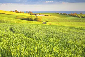 Blick über die Insel Møn
Photo: © Niels Thye/VisitDenmark
Klintholm Havn at a glance
- Location: Klintholm Havn lies on the eastern side of Møn’s south coast, near the landscape of Møns Klint.
- Harbor: Fishing boats, sailing yachts, and visitors share the harbor, which has both a fishing fleet and a marina.
- By the water: The harbor has a beach, along with cafés and restaurants on the waterfront promenade.
- Excursions: Boat trips from Klintholm follow the chalk cliffs; Møns Klint and the GeoCenter are in the eastern part of the island.
- Getting there: During the tourist season, bus route 678 connects Stege, Klintholm Havn, and the GeoCenter.
Harbor, marina, and beach
Everyday working life and vacation life meet right on the water in the harbor: fishing boats return, sailing yachts lie in the marina, and you can watch the comings and goings along the quay. If you’d like to take things at a leisurely pace, combine a stroll along the quay with a break at one of the waterfront restaurants or cafés. The view across the water and the proximity to the boats give Klintholm Havn a different character from the larger seaside resorts on the Danish Baltic coast.
The beach by the harbor adds some time by the sea to a visit. It’s a good place to pause after a walk or enjoy a short beach visit in its own right. You can move between harbor life and coastal air during the day without needing to plan a packed schedule. Families can pair a visit to the beach with a look at the boats; those staying longer will find places to eat and waterfront paths at the harbor.
By boat to Møns Klint
A boat trip offers a special perspective on the chalk coast. Trips depart from Klintholm Havn and follow the pale cliffs of Møns Klint. From the sea, the height and contours of the coastline are immediately apparent, and the views of the landscape are quite different from those at the viewpoints above the cliffs. Departure times and seasonal offerings depend on the local operator.
Møns Klint was added to the UNESCO World Heritage List on July 13, 2025. The chalk cliffs and the hills of Høje Møn show how Ice Age glaciers shaped the landscape. The GeoCenter adds to the visit with exhibitions and activities focused on nature and geology. If you’d like to explore the coast on foot, marked trails connect viewpoints and the cliff forest. Routes vary considerably in distance and walking time: the short Fossil Route is around 2.3 kilometers, while Klintekongens Rige is a long hike of about 14.5 kilometers.
For a day trip, you could start with the GeoCenter or a walk in the cliff forest, then follow a marked trail to the viewpoints, and finish by returning to Klintholm Havn. If you’d rather be out on the water, make the boat trip your own way to take in the coast. For an overview of the island and its other towns, see the guide to Lolland, Falster, and Møn.
Getting there and planning your day
Klintholm Havn fits easily into an island trip that takes in Stege, the chalk coast, and the south coast, each with its own character. During the tourist season, bus route 678 runs from Stege via Klintholm Havn to the GeoCenter Møns Klint. This makes it possible to combine a harbor visit and the cliff area without changing locations by car. The bus service is seasonal; if you’re traveling by public transport, the current timetable will determine which places are practical to visit in one day.
By car or bicycle, you can plan a stop at the harbor between Stege and Møns Klint. For a hike in the hilly cliff area, choose a route that suits the distance and time available in your day. A shorter trail leaves more time for the GeoCenter and harbor, while a longer loop makes the cliff forest the main focus. If you explore the coast by boat, you can make the harbor visit and trip part of one outing.
Where to stay around Klintholm
Your plans for the day can help you choose where to stay: accommodation in Klintholm Havn suits visits to the harbor, beach, and boat trips; the accommodation in Klintholm Havn is right in the local area. If you plan to visit several places on the island, the Møn island accommodation overview is a useful starting point. For a place to stay near the landscape around Møns Klint, Sømarke on Møn is another option in its own right.
Depending on the length of your stay, you can explore the region in different ways: a short visit can focus on the harbor and beach or a boat trip. For a full day out, add the GeoCenter, cliff forest, and selected viewpoints. If you’re staying for several nights, combine Klintholm Havn with Stege and other places on Møn, planning your travel around the experiences you want to enjoy.
Frequently asked questions about Klintholm Havn
What can I do in Klintholm Havn?
You can explore the fishing harbor and marina, relax on the beach, stop for a meal or drink on the waterfront promenade, or take a boat trip along Møns Klint. The harbor is also a good starting point for visiting the GeoCenter and the cliff trails.
How do I get from Klintholm Havn to the GeoCenter Møns Klint?
During the tourist season, bus route 678 connects Klintholm Havn with the GeoCenter. You can also combine the harbor and cliff area by car or bicycle; the walking distances at the site depend on the route you choose.
How much time should I allow for Møns Klint?
The short Fossil Route is about 2.3 kilometers and takes around 75 minutes. Longer trails such as Klintekongens Rige cover about 14.5 kilometers and take roughly six hours. Allow extra time for the GeoCenter, breaks at viewpoints, and travel, depending on your plans for the day.
