
Krzywin – Church, Cycling Routes and Nature
Accommodation in Krzywin
Krzywin is an oval-shaped village on the Southern Connecting Cycle Route. A Gothic parish church, two cycling routes with specified lengths, and the fact that parts of the village lie within Natura 2000 sites provide concrete points of reference when choosing the destination. This makes it possible to discover Krzywin from cultural, active and nature-related perspectives.
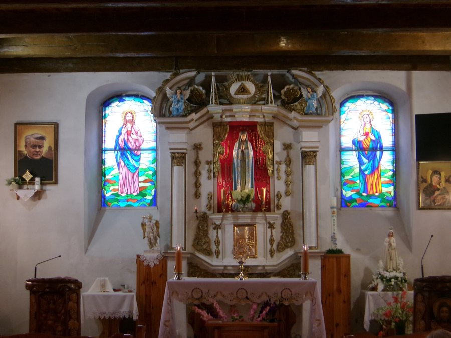
Gothic parish church and distinctive details
The parish church of the Immaculate Heart of the Blessed Virgin Mary in Krzywin is a Gothic building dating from the 15th century. It is made of fieldstone and brick and has a rectangular ground plan. Its wooden tower is incorporated into the body of the nave. These features give the building a clearly described form: its materials, ground plan and the position of the tower can each be considered individually.
Other architectural elements and fittings belong to different periods. The church preserves a decorative tracery gable from the 16th century; its bell dates from 1937. Thus, the same building brings together a Gothic church from the 15th century, a gable from the 16th century and a bell with a specific year of origin. The gable and the bell are separate details, not alternative dates for the church building.
A 3.5-metre-high sculpture of Pope John Paul II stands in front of the church entrance. It was created by Aleksander Fatiga from Krzywin. Alongside the architecture, the sculpture offers another concrete point of reference for exploring the town’s cultural history; its height, the person depicted and the artist are all clearly specified.
Cycling routes of different lengths
The blue Południowy Szlak Łącznikowy runs from Ognica via Rynica to Krzywin railway station. It is 8.95 km long and follows paved and unpaved roads. This gives cyclists a specific route, its length and the change between paved and unpaved surfaces to consider when choosing a ride.
Another route mentioned is the black Banie–Baniewice–Żelechowo–Krzywin cycle route. It is 19.0 km long and ends in Krzywin at the point where it meets the blue “Południowy” cycle route of the Widuchowa municipality. Compared with the blue connecting route’s 8.95 km, this black route has a different stated length. The information distinguishes the two routes by length and named course; no surface is specified here for the black route.
Natura 2000 sites and the village layout
Krzywin lies partly within the Dolina Dolnej Odry Natura 2000 site, a Special Protection Area for birds with the code PLB 320003. The village also lies partly within the Dolna Odra Natura 2000 site, a Special Area of Conservation for habitats with the code PLH 320037. The two sites have different conservation objectives: one focuses on birds, the other on habitats. Those interested in nature will find two precisely named protected areas here, distinguished by their conservation objectives.
In addition to the oval village layout, the settlement’s built-up area is concentrated along Voivodeship Road 122 on the Krajnik Dolny–Pyrzyce route, as well as along municipal roads. This adds a specific description of the village layout to the picture of Krzywin as a village on the Southern Connecting Cycle Route.
More local pages at a glance: Nawodna, Chojna, Steklno, Weltyn, Stare Czarnowo, Moryń, Widuchowa, Nowe Czarnowo.
For the broader travel overview: Greifenhagen.

