
Rymań: Hotels and accommodations
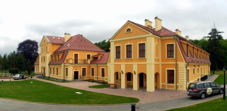 File:Rymań - Pałac A.jpg
Photo: Radosław Drożdżewski (Zwiadowca21) via Wikimedia Commons, CC BY-SA 3.0 pl
File:Rymań - Pałac A.jpg
Photo: Radosław Drożdżewski (Zwiadowca21) via Wikimedia Commons, CC BY-SA 3.0 pl
The municipality of Rymań is located on the Gryfice Plain. Its northern and central areas are predominantly agricultural, while forests cover 39 percent of the municipality. Lake Studnica is also located in Gmina Rymań on the Gryfice Plain; the water surface covers 33.1 hectares.
Nature
The wider regional area around Rymań includes Góra Iwki, Dżwirzyno Beach, and Kolobrzeg Beach.
Culture and history
The wider regional area around Rymań includes the Trzebiatow palace and castle complex – Zespol palacowo-zamkowy z XVIII w. – as well as Świdwin Castle – Zamek XIII-XIVw. In the wider regional area around Rymań, Starnin is home to a Protestant cemetery that was in use from the second half of the 19th century until the Second World War; the historic necropolis covers more than half a hectare. The Church of the Archangel Michael in Unieradz is considered one of the oldest examples of rural sacred architecture in Central Pomerania. Also in the wider regional area, the historic center of Kołobrzeg includes a 14th-century co-cathedral basilica and a neo-Gothic town hall from the first half of the 19th century.
Experiences
In the wider regional area around Rymań, a blue hiking trail runs from Ustronie Morskie to the Warcisław and Bolesław oaks in the Kołobrzeg Forest. The Mołstowa flows through Gmina Rymań; it is considered suitable for kayaking.
The same overarching destination also includes Dygowo, Stramnica, Dzwirzyno, Stary Borek, Kolberg, Nieżyn, Nowogardek and Leszczyn.
Check prices, availability, and amenities for your travel dates directly on Booking.com.
View accommodations and offersAdvertisement · Partner link to Booking.comBack to the overarching travel overview: Kolberg.

