
Barnówko: Palace Park and History
Accommodation in Barnówko
The palace park and traces of history give Barnówko a distinct character for travelers interested in nature and history. The park lies south of the village along the Myśla River and was laid out in the second half of the 18th century. Its landscape of ponds, some surviving old trees and several points of military-historical interest offer different perspectives on the place.
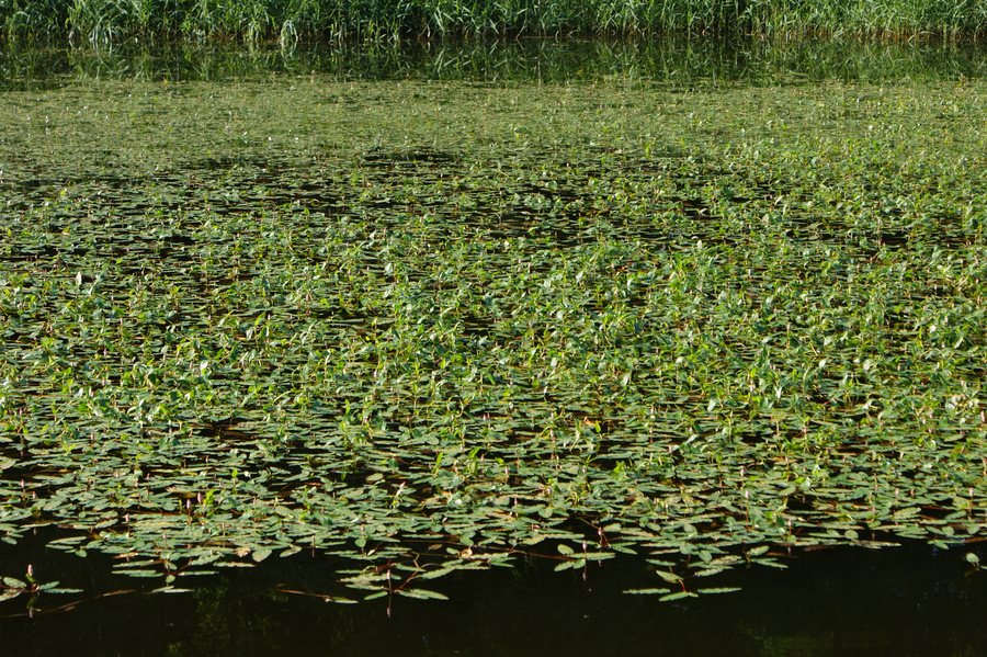 Persicaria amphibia, community in a pond near Barnówko by Myślibórz (NW Poland)
Photo: Krzysztof Ziarnek, Kenraiz via Wikimedia Commons, CC BY-SA 3.0
The palace park, between water and mature trees
The palace park covers 44 hectares, of which 36 hectares are fish ponds. This scale makes the ponds the defining feature of the grounds: they occupy a large part of the area. The fish ponds were created in 1781; the park itself was established in the second half of the 18th century. Both dates belong to the history of the grounds, but they differ in precision. A specific year is given for the ponds, while the park’s creation is assigned to a period. If you want to place the landscape in its historical context, you can distinguish the specifically dated pond area from the more broadly dated park.
Some valuable old trees have survived in the park, including two oaks named “Guślarze.” The two trees add a tangible connection to nature to the extensive ponds. This brings together different points of scale when choosing a destination: the large water area of the park grounds and individual named old trees. Travelers who prioritize landscape can therefore assess Barnówko not only by the size of the grounds, but also by its surviving trees.
Historical traces in the park complex
The historical points of interest in the park complex are varied. The ruins of the palace, which burned down during the war, are located there. A monument to a German soldier from the First World War stands in the park. The grounds also include the site of the former airfield of the 1st Fighter Regiment “Warszawa.” In this way, structural remains, individual commemoration and a military-historical site stand side by side.
The monument specifically commemorates a soldier from the First World War; the airfield reference, by contrast, names a unit, the 1st Fighter Regiment “Warszawa.” This distinction provides a clearer historical perspective: individual commemoration and the history of a military unit are separate themes. Along with the palace ruins, they offer different historical points of interest for anyone who wants to understand Barnówko through more than its parkland.
Routes in Barnówko and the surrounding area
The red Templar and Hospitaller Route passes through Barnówko; the village lies at kilometer 28 of the route. In the wider region, the red “Wokół Dębna” hiking trail is about 25 kilometers long. The two kilometer figures serve different purposes: kilometer 28 locates Barnówko along the Templar and Hospitaller Route, while about 25 kilometers is the approximate length of “Wokół Dębna.” This distinguishes a direct route connection to the village from the length of a hiking trail in the surrounding area. This is useful if you want to factor active travel interests into your choice of destination and use the route information for different planning needs.
Discover more destinations: Dabrowa, Rów, Parzensko, Zydowo, Nowogródek Pomorski, Barlinek, Dębno, Karsko.
Go to the main travel overview: Soldin.

