
Borne Sulinowo: Between Lakes and History
Accommodation in Borne Sulinowo
Borne Sulinowo combines landscapes shaped by the Ice Age with a distinctive military history. The nature reserve, lakes and cycling routes each offer a different way to explore the natural environment; the town’s history also takes you back to the time when Borne Sulinowo was the base and barracks for a military training ground. When planning your trip, you can consider nature trails, activities on the water and historical themes as separate focal points.
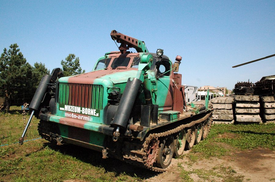 File:Borne Sulinowo - Muzeum Militarnej Historii - BAT - 14.08.2025 12-24-35.jpg
Photo: Photographs by Radosław Drożdżewski (User:Zwiadowca21) via Source, CC BY-SA 4.0
Nature Reserve and Glacial Lakes
The “Diabelskie Pustacie” nature reserve covers 932.04 hectares. Of this area, 637.63 hectares of the Nadleśnictwo Borne Sulinowo Forest District lie within the administrative district of Borne Sulinowo. The figures refer to different areas: 932.04 hectares is the total area of the nature reserve; 637.63 hectares refers to the forest district within the administrative district. The nature reserve lies within the Natura 2000 site of the same name.
The central section of the blue “Kraina Odwróconego Krzyża” cycling route passes through an unusual landscape formation. It follows two glacial valleys that meet at right angles and contain five lakes. Together, the valleys form the shape of an inverted cross, which gives the route its name. The cycling route starts and ends at an intersection in Borne Sulinowo. Both the lakes and the meeting of the valleys shape the landscape along this route.
The black “Kraina małych jezior” cycling route offers a different focus: it passes through pine forest with small glacial lakes and runs between the villages of Rakowo, Komorze, Okole, Uniemino and Strzeszyn. This route also starts and ends at an intersection in Borne Sulinowo. Compared with the blue route, pine forest and small lakes take centre stage here, while the blue route is defined by its two valleys and their cross-shaped formation. These landscape features offer a practical guide when choosing between the two cycling routes.
Nature Trail and Water Activities
A nature trail about 9.1 kilometres long leads from the vicinity of the former Soviet cemetery in Borne Sulinowo to a vehicle rest area by Lake Rymierzewo. It can be explored on foot or by bicycle. Its named starting point, destination and approximate length clearly distinguish it from the two cycling routes, whose descriptions focus primarily on landscape formations.
Other water activities take place in different locations. In the municipality of Borne Sulinowo, the Piława is the largest river and a popular, attractive canoeing route. Near an island close to the town is the “sunken forest,” a popular diving site. Canoeing and diving therefore each have their own geographical setting: the Piława in the municipality, and the diving site near the town.
Military History and Piknik Lotniczy
The town’s history is closely connected with the military training ground: Borne Sulinowo originated as its rear base and barracks and was home to the Wehrmacht artillery school. This historical background adds another perspective on the town to the descriptions of nature and routes. Alongside the glacial landscape, visitors interested in the development of Borne Sulinowo can also encounter its military past.
Piknik Lotniczy took place at the sports airfield during the first days of May. If you would like to plan your trip around this event, check the specific dates in advance.
Discover more destinations: Sitno, Drezno, Szczecinek, Spore, Silnowo, Pilawa, Krągi, Stare Wierzchowo.
For the broader travel overview: Neustettin.

