
Ogonki on Lake Święcajty
Accommodation in Ogonki
Ogonki lies on Lake Święcajty and combines an unsupervised beach with a location on a waterway and several described cycling routes. When choosing your destination, you can weigh different interests: time at the lake, sailboats, bike rides or a look at the history of the place. When searching for a hotel in Ogonki, it is helpful to first understand the local features rather than reduce your stay to a single experience.
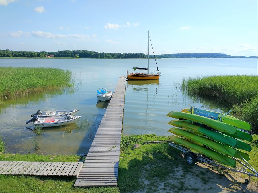
A lake with an indented shoreline
Lake Święcajty is an arm of Lake Mamry. It covers 874 hectares and reaches a depth of up to 28 meters. Its highly indented shoreline and two islands give the body of water a distinct shape: it is not a narrow stretch of water with a straight shore, but a lake with a pronounced course and islands. Those interested in Ogonki as a base will find a place whose character is closely connected to Lake Święcajty. The figures describe its size and maximum depth; the shoreline and islands add the visible contours of the lake to this picture.
Beach and getting oriented in town
Kąpielisko Ogonki is an unsupervised beach on Lake Święcajty. At the same time, it lies directly next to National Road 63 and is separated from it by barrier fencing. This location is part of getting oriented locally and should be taken into account when assessing a beach visit for yourself. Across the road from Kąpielisko, there are ice cream stands, cafés and restaurants. There are also mountain bike rental shops and a parking lot there. The beach, dining options and rental shops are distinct local amenities; the dining options are across the road from the bathing area.
Waterway and sailing
Ogonki has a sailing harbor. There is also a wooden pier at Kąpielisko where sailboats can moor. The Mamry–Sapina waterway ends at the mouth of the Sapina River where it flows into Lake Święcajty in Ogonki. The water route across Lake Mamry and Lake Święcajty is classified as a Class II waterway. These are three distinct details for understanding the place: the sailing harbor in Ogonki, the pier at Kąpielisko and the waterway’s endpoint at the river mouth. Together, they show the role of water in the character of the place, without implying any further information about schedules or conditions of use.
Cycling routes and scenery along the way
Cycling trips also offer a distinct way to experience Ogonki. The cycling loop around Lake Stręgiel follows a route to Ogonki laid out on a former railway line and passes through marshy landscapes. On the stretch from Pozezdrze to Ogonki, this route coincides with the blue “Błękitna wstęga jezior” cycling trail. This makes it possible to identify the route by its named places, its former railway alignment and the landscapes it passes through. Another described connection starts at the promenade: from there, a comfortable cycle path branches off from the Green Velo cycling route and follows the former railway line toward Ogonki. These details refer to different route descriptions; they should not be combined into a single route.
A look at local history
There is a World War II bunker by the bridge in Ogonki. It served as a fortification at the strategic passage between the lakes. The place can therefore also be viewed through its historical function: the passage between the bodies of water was not only a geographical connection, but also played a strategic role during World War II. Another historical aspect is part of the lake’s story: before the war, Ogonki and Lake Święcajty were known for ice sailing. This former renown is a historical reference, not a statement about current offerings.
More places in the same broader area: Jakunówko, Pawłowo, Trygort, Budry, Wesołowo, Pozezdrze, Kal and Łabapa.
Back to the broader travel overview: Węgorzewski.

