
Discover Dobrzany
Accommodation in Dobrzany
Dobrzany combines a medieval town layout and reconstruction after 1781 with trails that pass through the town. If you are interested in architectural history, the Church of St. Michael the Archangel offers a concrete starting point. If you would rather include longer routes in your trip, two long-distance hiking trails offer a different way to explore the surrounding area.
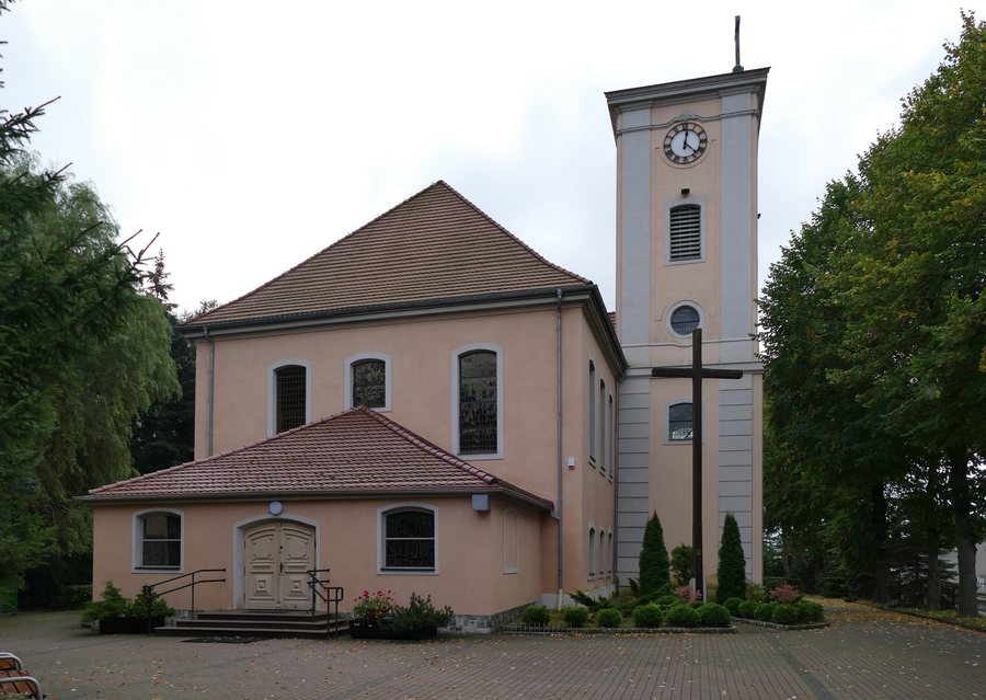
Church and town layout
The Church of St. Michael the Archangel was built between 1782 and 1784 and designed by David Gilly. It is the only surviving building in Dobrzany designed by Gilly. Together with the churchyard, it is listed in the register of monuments under registration number A-1210. The churchyard dates from before 1781. The church and its surroundings can therefore also be considered in the context of the town’s architectural history, without conflating the dates when the two parts originated.
The town layout combines a medieval town plan with reconstruction after the fire of 1781. This reconstruction took place in the 18th century according to a plan by Gilly. The plan called for a regular arrangement of residential plots. Each pair of buildings was to be arranged with its gables facing the street. This plan adds another layer to the picture of the town: the older layout alongside its reorganisation after the fire. Visitors exploring Dobrzany from a cultural and historical perspective can consider the church and town planning as distinct aspects of this transformation.
Early medieval fortifications
The fortifications also point to different periods. In the east of the town is an early medieval ring-shaped hillfort with a double earthen rampart, dated to the 9th–10th centuries. In the west is an early medieval fortified site dating from the 11th–12th centuries. The two sites differ both in their location within Dobrzany and in their stated dates. They therefore offer history-minded visitors two specific topics to distinguish when considering the town’s former fortifications.
Hiking trails and landscape
The green Wzniesienia Moreny Czołowej Trail and the red Stargard–Recz Trail intersect in Dobrzany. The green trail is 51 km long and passes through Dobrzany. Along its route, you can observe landforms shaped by the glacial moraine landscape. This trail therefore focuses not only on its route but also on the landscape’s formation.
The red Hetman Stefan Czarniecki Trail runs for 62.5 km from Stargard to Recz and passes through Dobrzany. The town is marked as a waypoint at kilometre 41.3 from the stated starting point. The trail’s name recalls the stationing of Polish troops under the command of Hetman Stefan Czarniecki in the region in 1657. This means that the green trail offers access to the landforms of the moraine landscape, while the red trail also has a connection to this regional historical event. The two routes thus have different stated focuses, without confusing their lengths or themes.
Other places in the same destination selection
If you would like to explore other places within the same broader destination selection in addition to Dobrzany, you can find Rekowo, Morzyczyn, Insko, Brudzewice, Żukowo, Chociwel, Stargard Szczeciński and Koszewko here.
For the broader travel overview: Stargard.

