
Cruising Guide to the Danish South Sea: Sailing Area and Copenhagen
Tom Logisch’s cruising guide to the Danish South Sea combines sailing-area information with ideas for shore excursions. The edition takes readers from German charter bases into the Danish archipelago, with an additional cruise devoted to Copenhagen. Its routes, harbours and regional insights make the book a thematic planning guide for a sailing holiday.
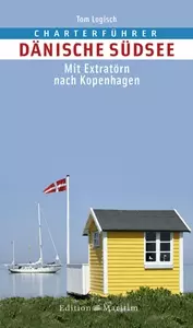 Cruising Guide to the Danish South Sea: Sailing Area and Route Planning
Photo: © Delius Klasing Verlag
Cruising guide at a glance
- Title: Cruising Guide to the Danish South Sea – with an Extra Cruise to Copenhagen
- Author: Tom Logisch
- Publisher: Edition Maritim, Delius Klasing
- Edition: First edition, 2015
- Length: 160 pages and 140 colour photographs
- Navigation aids: 59 plans and charts
- Format: 13.6 × 22.3 centimetres, spiral binding with cover
- ISBN: 978-3-667-10027-6
A sailing area between South Funen and the German coast
The publisher describes the Danish South Sea as an island sailing area south of Funen. The cruising guide starts from German charter bases and ports of departure, and covers destinations beyond the immediate archipelago, including the larger Danish Baltic islands. For regional orientation, it includes Funen, Langeland and Ærø, Lolland, Falster and Møn as well as Zealand. An extra cruise takes readers to Copenhagen. The book also names the island of Als and the Flensburg Fjord as part of the sailing area it describes.
This makes the title a good fit for a trip combining a German starting point with Danish island harbours and longer passages. The regional overview of water sports in Denmark places the sailing area within the variety of Denmark’s coasts, fjords and island waters. For an overnight stay on land before or after a charter, the accommodation selection in Schleswig-Flensburg is a suitable regional complement to the German departure points.
Route planning and information on board
The publisher identifies support with cruise planning and execution as the book’s central purpose. It describes charter bases and ports of departure, presents destinations for one- to two-week cruises starting in Germany, and supplements the routes with suggestions for leisure activities. Information about the sailing area, climate, wind and weather, as well as the country and its people, helps readers prepare for their trip. The book provides detailed harbour descriptions and colour plans.
The sections can help you put together a route to suit your preferred duration and interests: first choose a suitable German departure point, then connect island destinations and moorings, and finally allow time for shore visits. The additional Copenhagen cruise adds an urban destination to the options. The colour photographs and charts give an overview of the stages, while the compact ring-bound book also makes useful reading when preparing for the trip.
What the guide adds for shore visits
Features on life in Denmark and suggestions for activities ashore help turn a harbour stop into a more complete visit. The publisher describes author Tom Logisch as an expert on the sailing area and highlights his many years of experience in the Danish South Sea. This combination of local sailing knowledge, harbour descriptions and ideas for shore visits gives the book its practical value.
This first edition was published in 2015. It provides a regional basis for choosing routes and finding travel ideas. For actual navigation, up-to-date charts and official nautical information should be carried on board; wind, weather and harbour conditions also depend on when you travel. The book’s content complements this current cruise preparation with the destinations, plans and background information it describes.
Frequently asked questions about the cruising guide
Which areas does the book cover?
The focus is on the islands south of Funen. The book describes charter bases and ports of departure on the German coast, destinations for one- to two-week cruises, Danish island harbours and an additional cruise to Copenhagen.
What information will charter skippers find in it?
The publisher lists information on the sailing area, climate, wind and weather; detailed harbour descriptions; colour plans; and insights into the country and its people, along with suggestions for leisure activities.
How extensive is this edition?
The 2015 edition has 160 pages, 140 colour photographs, and 59 plans and charts. It has a spiral binding with cover and ISBN 978-3-667-10027-6.
