
ADAC Illustrated Travel Book: Germany’s Baltic Coast
The ADAC illustrated travel book “Germany’s Baltic Coast” brings together coastal landscapes, towns and excursion destinations between Schleswig-Holstein and Mecklenburg-Western Pomerania. The 2015 edition combines large-format color photographs with regional information and a removable fold-out map. The hardcover volume has 240 pages.
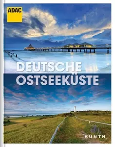 ADAC Illustrated Travel Book Germany’s Baltic Coast: Contents and Overview
Photo: © Kunth-Verlag
ADAC illustrated travel book: key facts
- Title: Germany’s Baltic Coast
- Series: ADAC illustrated travel book, published by Kunth
- Edition: 2015
- Length: 240 pages, hardcover with dust jacket
- Format: 23.1 × 29.5 centimeters
- Features: removable fold-out map
- ISBN: 978-3-95504-087-1
From the fjords to the islands
The book divides Germany’s Baltic coast between the two coastal states of Schleswig-Holstein and Mecklenburg-Western Pomerania. Featured areas include the islands of Rügen, Usedom and Fehmarn. Coastal towns and cities near the shore are also covered, including the Flensburg Fjord in the north. The selection therefore ranges from island and beach scenery to urban destinations.
The book also features Schwerin. The state capital lies inland, about an hour’s drive from the Baltic coast, and adds a city destination to the coastal region. After reading, travelers choosing a base can therefore decide between staying right on the coast, spending time on an island or taking a trip inland. For a stay at a seaside resort, the accommodation options in Binz offer a convenient base on Rügen’s Baltic coast.
Attractions, recreation and regional themes
Beyond descriptions of places, the book introduces important attractions in the region. Additional chapters cover leisure, sports and outdoor activities. This range of topics makes it easy to move from scenic impressions to specific ideas for places to visit: a coastal trip can combine beaches and cliffs with historic town centers, nature areas or a sporting excursion.
Using the illustrated book and fold-out map
The large-format book features color photographs and short articles about the region. The images give a visual impression of the landscapes, while the text provides context about places and attractions. The removable fold-out map complements the illustrated book with an overview of the area. When planning, it helps show which islands, fjords and cities are close to one another and which destinations merit a separate leg of the trip.
With 240 pages, the edition offers material for an extended read or for looking up specific coastal areas. The combination of photographs, information about places and a map is especially useful if you want to gather ideas first and then choose a region.
Who this edition is for
This illustrated travel book is suited to readers who want to get to know Germany’s Baltic coast as a whole region. The two federal states provide the framework, while chapters on islands, fjords and coastal cities highlight the variety within the area. Anyone looking mainly for photographs and a concise regional overview will find both in this edition.
Frequently asked questions about the illustrated travel book
Which coastal regions does the book cover?
The focus is on Schleswig-Holstein and Mecklenburg-Western Pomerania. Destinations featured include Rügen, Usedom, Fehmarn, the Flensburg Fjord and Schwerin, the inland state capital near the coast.
What features does the edition offer?
The hardcover volume with dust jacket has 240 pages and measures 23.1 × 29.5 centimeters. A removable fold-out map complements the large-format color photographs and regional text.
Is this illustrated book an up-to-date guidebook?
The edition described was published in 2015. It is suited to getting your bearings in the region and gathering travel ideas.
