
Cerkiewnik: Brick Church and Routes
Accommodation in Cerkiewnik
Cerkiewnik can be explored through two clearly distinct themes: the Neo-Gothic Church of St. Catherine and St. Anne, and cycling and hiking routes that include the village as a starting point or stop. When planning, it helps to first decide whether you want to focus on architecture, a shorter cycling loop, or a longer hike. The church stands on a hill in the centre; several tours pass through Cerkiewnik or start and end there. This makes it possible to consider the village’s character and an active day’s itinerary as distinct focuses of a stay.
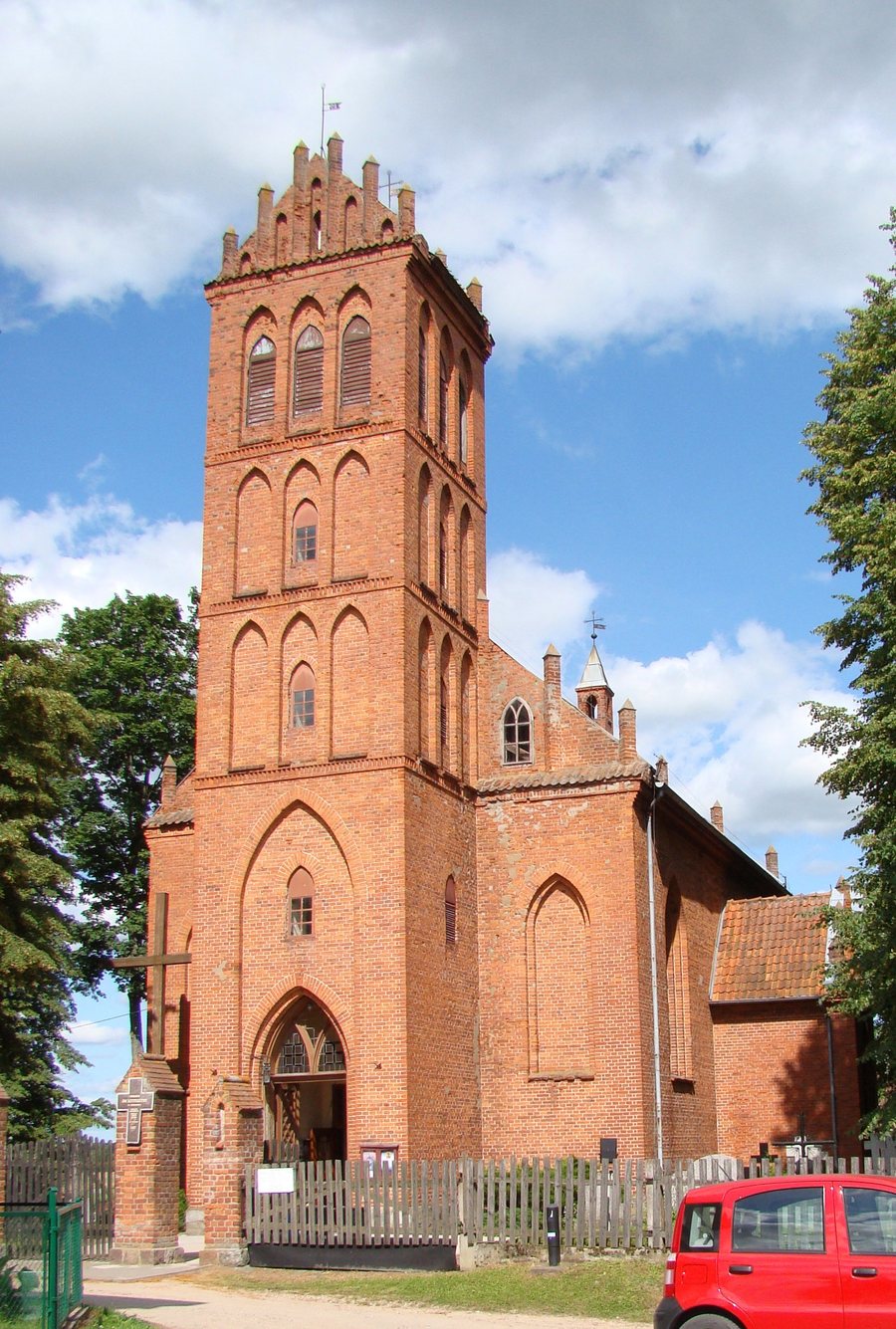
Neo-Gothic Church in the Village Centre
The Church of St. Catherine and St. Anne is an east-facing hall church built of red brick, with a rectangular ground plan. Its Neo-Gothic design draws on forms of medieval architecture in Warmia. Several specific features come together here: its east-facing orientation, the unified hall space, its rectangular plan, and the brick construction. The term “hall church” refers to the unified main space; it distinguishes this building type from churches whose layout is divided into several naves. Those interested in church architecture and regional building styles can take these architectural details into account when choosing a destination. Its location on a hill in the centre also gives the building a prominent place in the village’s character.
Cycling Routes with Different Starting Points
The 17 km cycling route starts in Cerkiewnik and returns there after a loop through Barkweda, Bukwałd, and Różynka. It therefore starts and ends in the same place. The 20 km cycling route follows a different layout: it starts in Dobre Miasto, passes through Głotowo, Swobodna, Lake Limajno, and the Chmury forest district to Cerkiewnik, then returns to Dobre Miasto via Swobodna and Knopin. The routes differ by three kilometres and, above all, in their starting and ending points. If you are looking for a cycling loop that starts and ends in Cerkiewnik, you can compare the 17 km route with the longer round trip, which includes the village as a stop. The distance and listed places provide an initial guide for planning your own trip.
Hiking Routes by Distance and Destination
There are also two markedly different distances to choose from for hiking. The 42 km hiking route starts in Olsztyn, passes through Brąswałd to the bridge over the artificial channel of the Łyna, then continues through Barkweda and Bukwałd to Cerkiewnik. From there, it goes via Głotowo and Dobre Miasto to Smolajny. The 87 km Copernicus Hiking Trail also starts in Olsztyn and passes through Cerkiewnik, Dobre Miasto, Smolajny, and Lidzbark Warmiński to Mingajny. Both routes pass through Cerkiewnik; the first ends in Smolajny, while the Copernicus Hiking Trail continues as far as Mingajny. At 45 km longer, the second trail is considerably longer. When choosing a hike, you can weigh the total distance against your preferred destination; the named intermediate stops also help indicate the route.
For your stay, you can first decide whether to focus on architecture or a cycling or hiking tour. Check the current route before setting out.
Discover more destinations: Biskupiec, Jeziorany, Nowa Kaletka, Olsztynek, Purda, Mierki, Unieszewo, Butryny.
Go to the main travel overview: Olsztyn.

