
Berlin–Usedom Cycle Route: route and stages
The Berlin–Usedom Cycle Route connects Berlin city centre with Peenemünde on Usedom, covering around 337 kilometres through Brandenburg and Mecklenburg-Western Pomerania. The journey shifts from urban streets to lakes, forests and the open countryside of the Uckermark, before reaching the Szczecin Lagoon and the island coast.
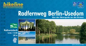 Radwandern zwischen Berlin und Usedom
Photo: © Verlag Esterbauer
Berlin–Usedom Cycle Route: key facts
- Start and finish: Berlin Palace Square and Peenemünde on Usedom
- Length: around 337 kilometres, according to Berlin.de and Usedom Tourism
- Federal states: Berlin, Brandenburg and Mecklenburg-Western Pomerania
- Route marker: green sign featuring the Brandenburg Gate, a cyclist and a seagull
- Character: urban stretches, forest and country lanes, lake scenery and island coastline
- Stages: can be divided up as you wish; Reiseland Brandenburg describes individual sections with start and finish points
From Berlin to the forests and lakes of Brandenburg
The route begins at Palace Square in Berlin-Mitte. From there, it heads out of the city through Prenzlauer Berg, Pankow and Buch. Bernau and Biesenthal mark the transition into the Barnim region. Further north, forests and lakes shape the route: the trail passes Lake Werbellin before reaching Joachimsthal. Here, the ride out of the city becomes a tour through a landscape defined by water and woodland.
The section from Joachimsthal to Warnitz is a well-documented example of how to plan the stages. Reiseland Brandenburg gives this third stage a distance of 41 kilometres. It passes through the Schorfheide-Chorin Biosphere Reserve and continues across the rolling Uckermark to Lake Oberuckersee. The route description names Parlow, Glambeck, Wolletz and Steinhöfel among the places along the way. The changing scenery of lakes, woodland and open countryside makes this stretch more varied than a steady ride along the coast.
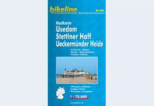 The map of Usedom, the Szczecin Lagoon and the Ueckermünde Heath comes from a 2010 edition and provides a historical overview of the area. For current route information, follow today’s route markers and consult up-to-date route details.
Through Western Pomerania to the Szczecin Lagoon
Beyond Lake Oberuckersee, the cycle route continues via Prenzlau towards Pasewalk and Torgelow. As the route enters Western Pomerania, rivers and lagoon landscapes come to the fore. Ueckermünde, on the Szczecin Lagoon, is a notable stop before the island section. The overview of Western Pomerania and the Szczecin Lagoon puts the region in context; for a visit to the town, the page on the Ueckermünde seaside resort provides more information about the old town and lagoon waterfront.
You can plan the stages to alternate longer and shorter days in the saddle. The range of accommodation in Ueckermünde makes it a possible base for an overnight stay by the lagoon.
Across the lagoon to Usedom
The final section crosses to Usedom via the island’s western access point and continues north to Peenemünde. For the crossing to the island, Usedom Tourism describes the ferry at Kamp or the lift bridge at Zecherin. The route then passes through the town of Usedom and heads north across the island. The Usedom island overview helps distinguish the coastal resorts from the island’s inland areas. If you would like to explore the island on a separate coastal ride, Usedom’s coastal cycle tour is a good addition.
Peenemünde is the northern terminus of the long-distance route. The cycling guide to Western Pomerania brings together more regional routes and cycling holiday ideas.
Plan your stages and equipment sensibly
Berlin.de recommends allowing at least four days for the full route and describes how to divide it up according to your fitness level. The distance you cover each day also depends on how much time you want to leave for towns, breaks and side trips. The 41 kilometres between Joachimsthal and Warnitz are an example of a moderate-length stage. A longer trip allows for extra overnight stays and detours, while experienced cycle tourists can combine several sections.
The route uses a variety of surfaces: Berlin.de mentions country roads and forest and field tracks, as well as paved cycle paths. A touring bike that rides comfortably on both paved and unpaved roads is therefore well suited to the changing terrain. Choose your luggage and daily distances to suit your needs. The green cycle-route signs help with navigation, while maps or digital route information are useful supplements, particularly in towns and at junctions.
Taking the train to an intermediate stop or returning by train from the finish can divide the trip into shorter sections. Berlin.de lists Bernau, Biesenthal, Eberswalde, Angermünde, Prenzlau, Pasewalk and Anklam among the places along the corridor that can be reached by train. Which services carry bicycles and which connections work for your travel day depends on the current timetable. When planning, it is therefore helpful to choose a starting or finishing section based on the nearest accessible station, as well as the daily distance you have in mind.
This page is an ADVERTISEMENT by publishing house Esterbauer
Frequently asked questions about the Berlin–Usedom Cycle Route
How long is the cycle route?
Berlin.de and Usedom Tourism give the distance as around 337 kilometres. The exact distance may vary slightly depending on which version of the route you follow.
How many days should I allow?
Berlin.de recommends at least four days for the full route. Splitting the journey over more days leaves extra time for breaks and sightseeing; you can adapt the stages to your fitness level and interests.
Where does the route end on Usedom?
The cycle route ends in Peenemünde, in the north of the island. Before that, the island section passes through the town of Usedom, linking the lagoon area, the island’s inland landscapes and the Baltic coast.
